


Projects
Click an image below to learn more about my projects.
Ongoing Project:
Reimagining the Bow River Pathway
with the Sunnyside Brightening Committee
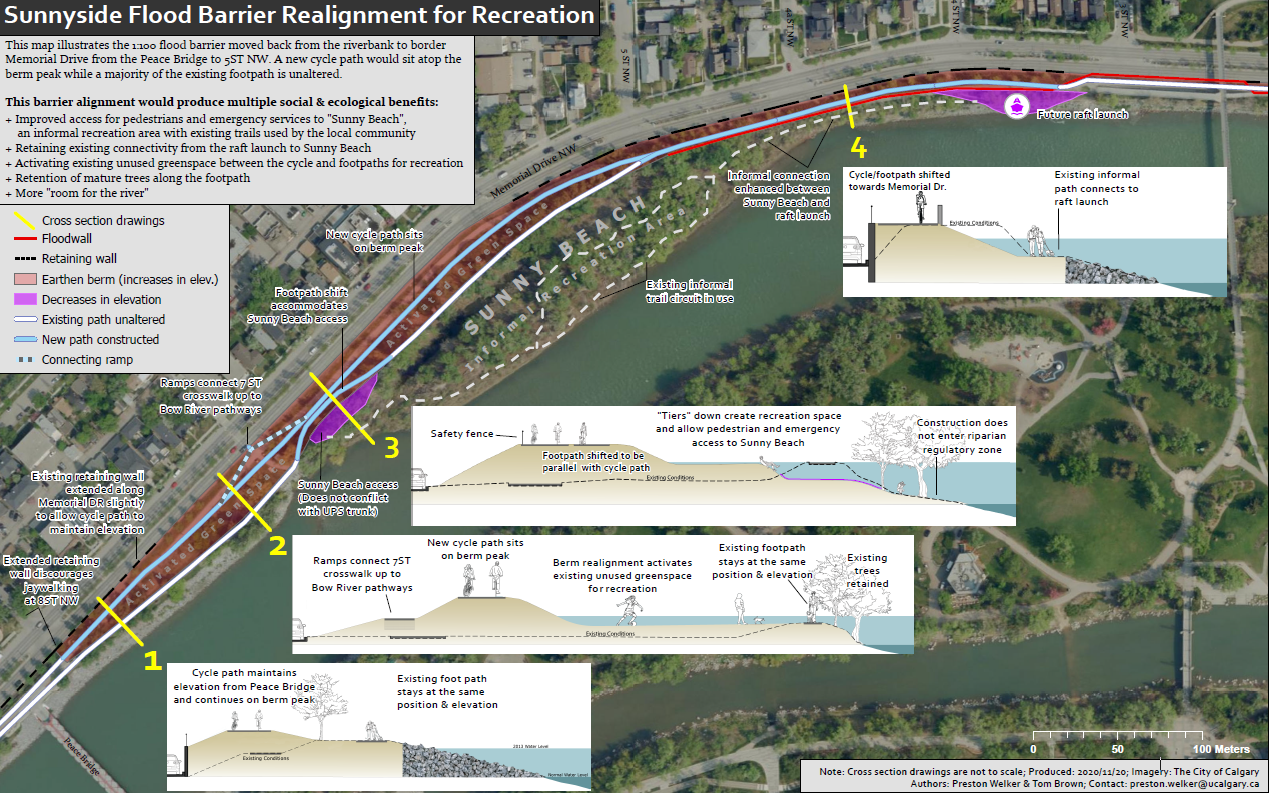
The Bow River Pathway is visited by thousands of Calgarians daily. The north bank of this greenway doubles as a levee to protect the Sunnyside community from river flooding. This levee will be built higher in coming years, requiring a complete redesign of the greenway. Summer of 2020, a group of Sunnysiders and myself organized the Sunnyside Brightening Committee to collaborate with the City of Calgary to Reimagine the Bow River Pathway.
Ongoing Project:
Murals of Resilience
with the Sunnyside Brightening Committee
![]()
Following the 2013 Southern Alberta flooding events, community organizers in Sunnyside have spent years working with the City of Calgary to mitigate flood risk. One success is the construction of Stormwater Lift Station #1. At the request of community members, the site includes two spaces for community art. The Sunnyside Brightening Committee is working to fund local artists to help communicate the story of the community’s resilience.Citizen Science for Climate Resilience at
Cove Mountain Preserve

Cove Mountain Preserve’s historic use for timber harvest produced a maze of overgrown logging roads throughout its forests. Community volunteers utilized Avenza Maps to translate their local knowledge into GIS data to help connect a larger a climate resilient landscape. By fall of 2018 these trails were open for public recreation.
Stream Mapping at
Great Smoky Mountains National Park
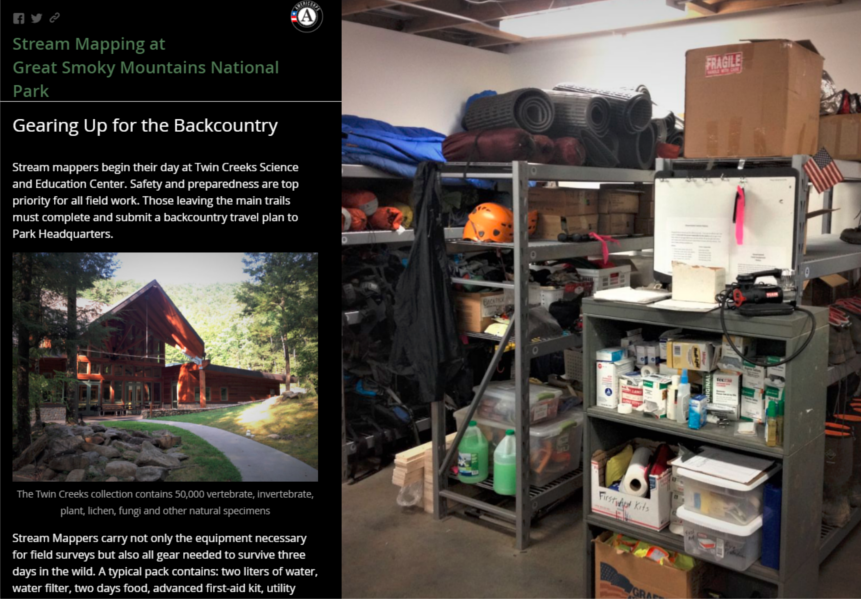
This StoryMap describes a day’s work as a Stream Mapper with the National Park Service. Stream Mappers use GIS to predict missing tributaries, navigate arduous terrain to find them, then conduct hydrologic and biological assessments. They data they collect contributes to the National Hydrography Dataset. (this app doesn’t play nice with phones)
Water Quality Atlas for
The Environmental Quality Institute
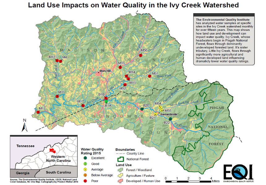
Produced for the Environmental Quality Institute, this series of maps visualizes water quality data collected throughout Western North Carolina. At some locations samples have been collected by volunteers for over fifteen years.
Collector Application for
Vernal Pools Assessment
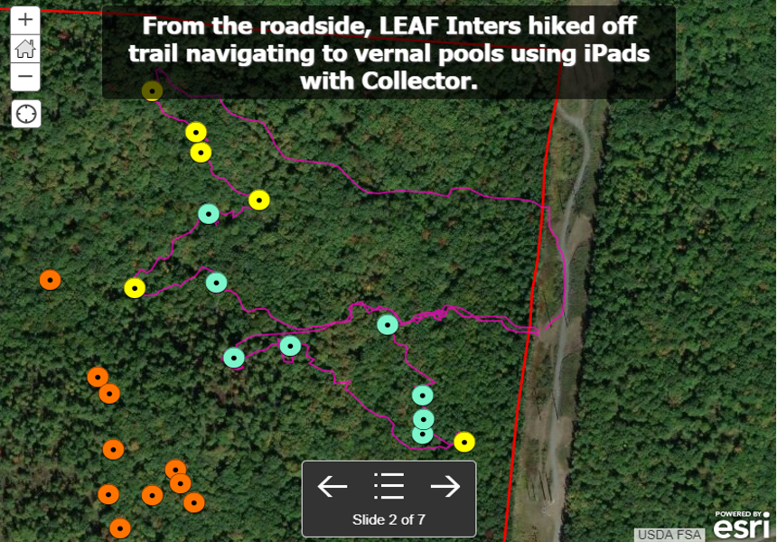
With this application, LEAF interns (Leaders in Environmental Action for the Future) learned to navigate in the field and collect data using Collector for ArcGIS. Interns logged their removal of invasive vegetation and restoration efforts of vernal pools.
LightHawk Flight Planning to Host
PA Congressman Charlie Dent
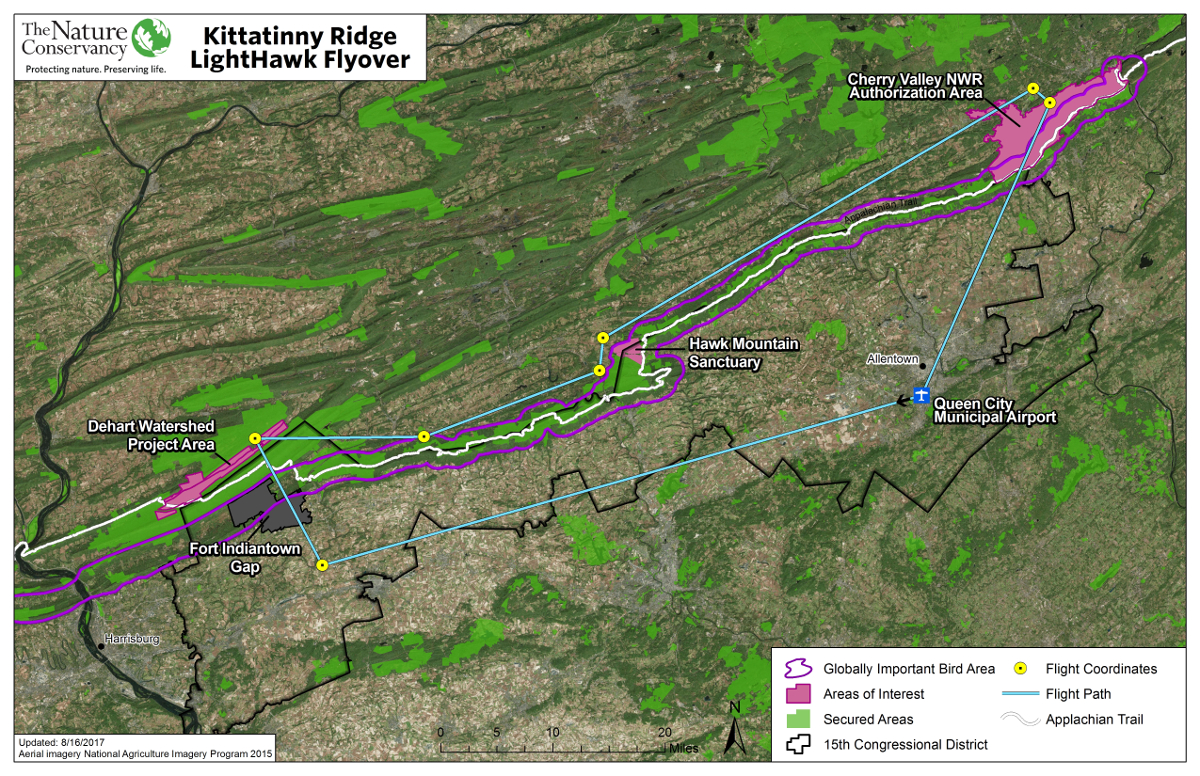
To promote conservation of the Kittitanny Ridge, The Nature Conservancy hosted Pennsylvania Congressman Charlie Dent on a LightHawk flyover of several key protection areas. GIS was utilized for flight planning and to enable tablets with digital location maps during flight.
2018 Healthy Lands & Waters
Birding Challenge Map
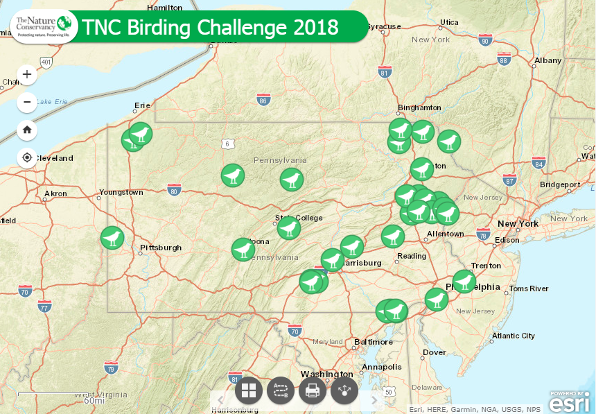
This interactive webmap displays all Pennsylvania locations for The Nature Conservancy’s annual Birding Challenge. This map was produced to promote the event via social media, email invitations, and volunteer newsletters.
GIS Analysis -
Co-Benefit Development In Siting Green Stormwater Infrastructure
![]()
Philadelphia Water Department’s
Green Cities, Clean Waters initiative aims to manage the city’s combined sewer overflow system with 100% green stormwater infrastructure. The Nature Conservancy has partnered to aggregate social and ecological co-benefits into these projects. A team of community
stakeholders, GIS professionals, engineers, conservationists and the city of Philadephia are working together to create habitat, reduce pollution, and improve quality of
life.
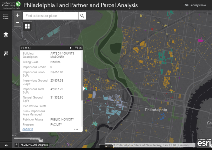
Data not available to the public.
GIS Analysis - Multistate Working Woodlands Landowner Assessment
![]()
Working Woodlands is a forest conservation program which leverages the voluntary carbon market to fund improved forest management and conservation. Originating in Pennsylvania, this program is now growing in several other states. These analyses and web-tools are helping conservation directors prioritize efforts as well as identify landowners and build relationships with potential enrollees.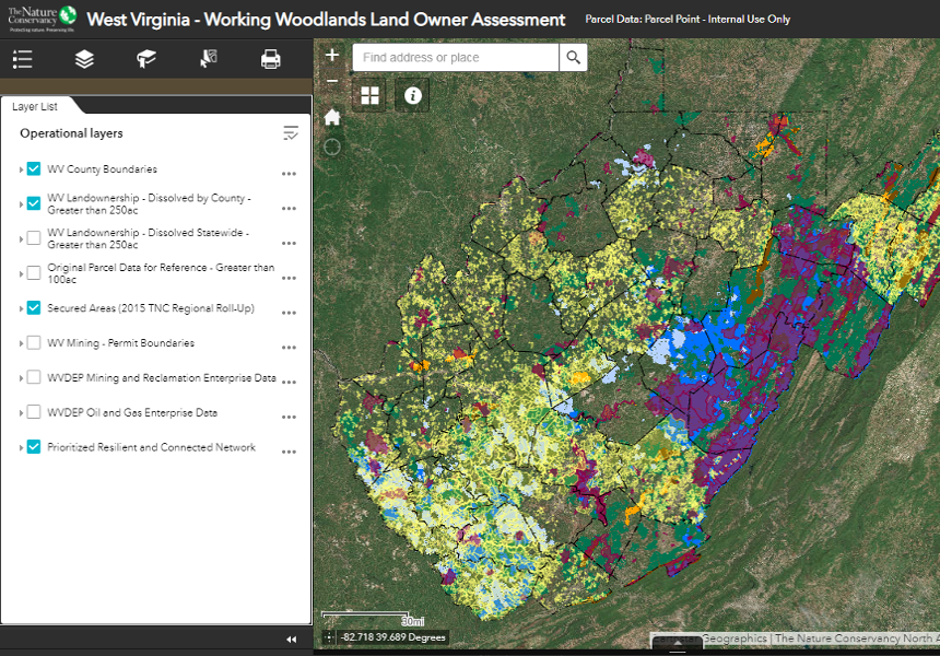
Data not available to the public.