
LightHawk Flight Planning to Host Pennsylvania Congressman Charlie Dent
Pennsylvania’s Kittatinny
Ridge is a 185 mile-long ridgeline stretching through the Central Appalachian Mountains. With a nearly continuous
north-south geography, the ridge is an ideal migration corridor for
species facing the pressures of land development and a changing climate - making it the focus of regional land conservation efforts.
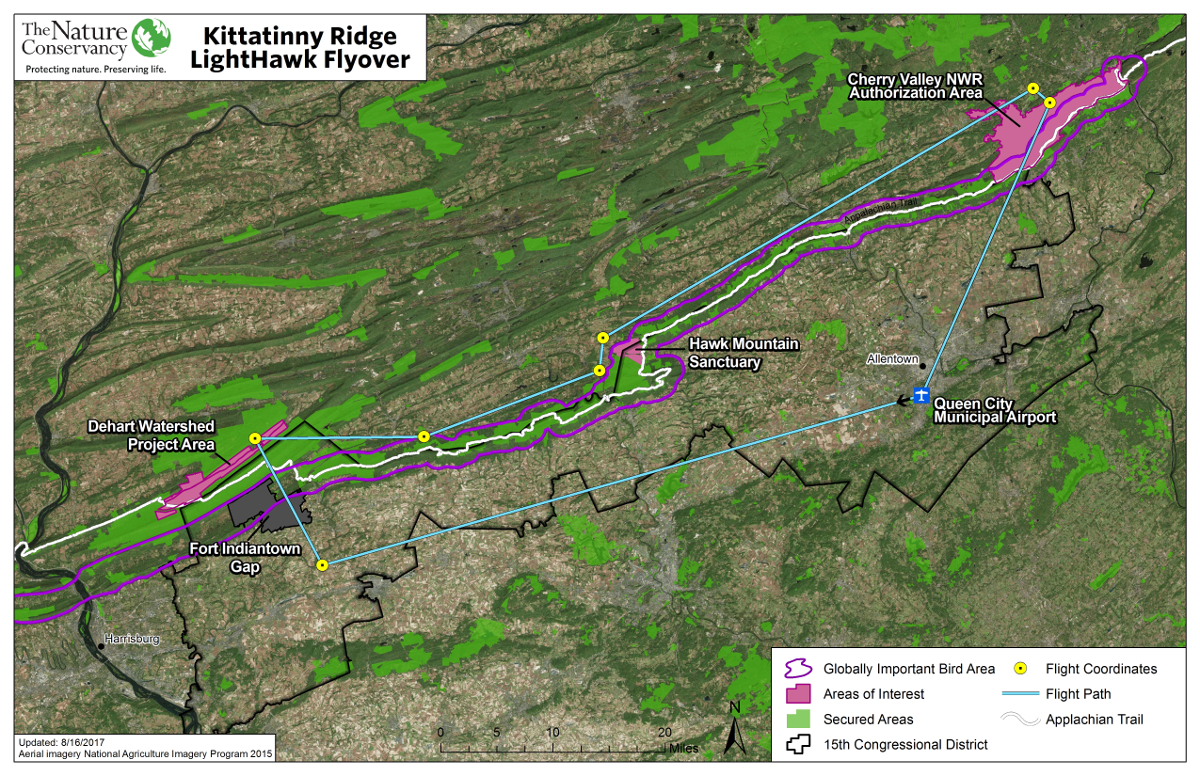
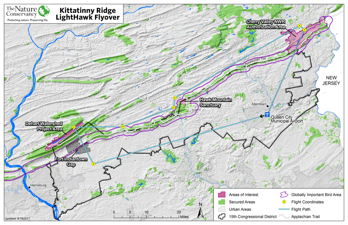
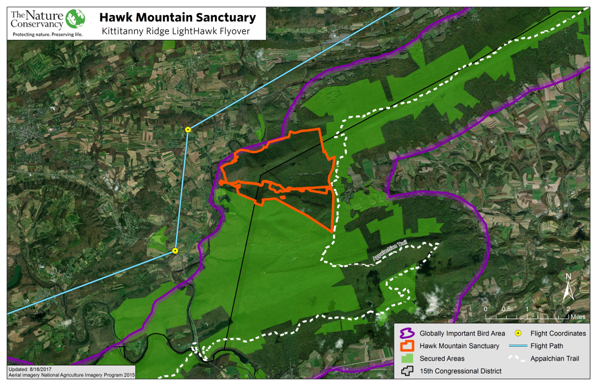
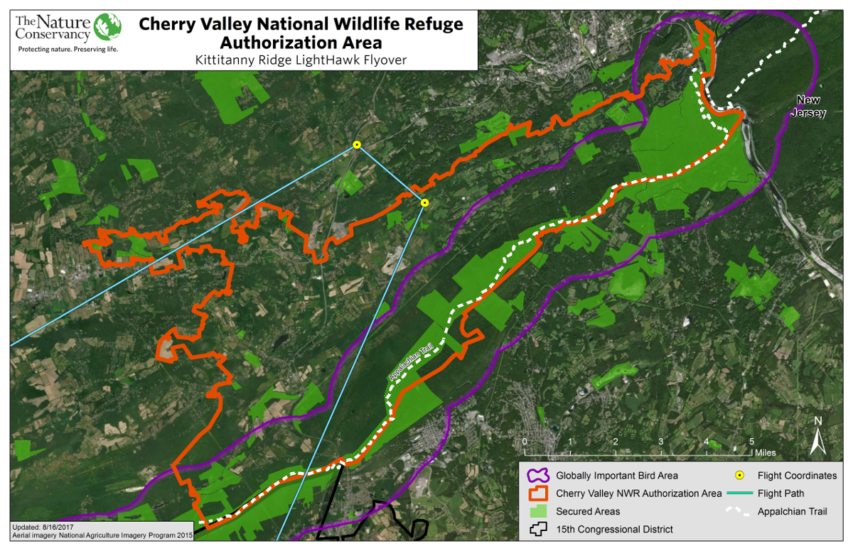
With the help of LightHawk, summer of 2017 Republican Congressman Charlie Dent joined The Nature Conservancy for a hawk’s-eye view of the Kittatinny ridge. I produced a flight plan for a light aircraft to fly a section of the ridge and view several key areas of interest. Time, distance, and restricted airspace were all taken into consideration. The collection of maps below was loaded into Avenza Maps on GPS enabled iPads allowing passengers in flight to view their realtime location and collect data on locations of interest.
Flight Plan on iFlightPlanner - Aviation Charts
This video explains the importance of the Kittitanny Ridge and features one of my maps at 1:18