
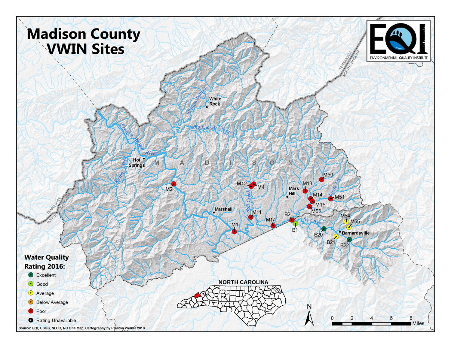
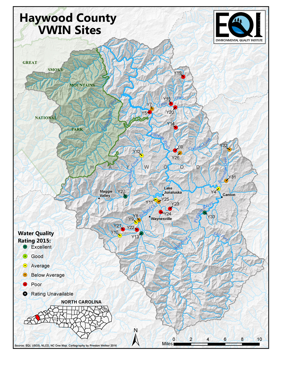
The Environmental Quality Institute: Water Quality Atlas
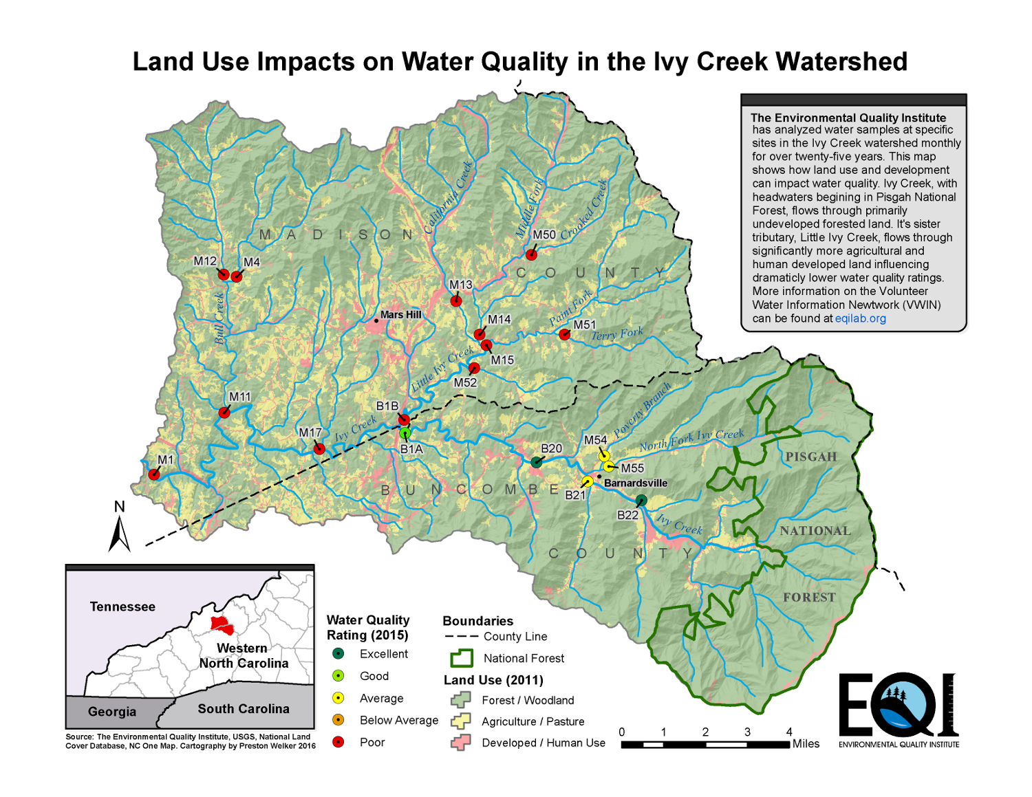
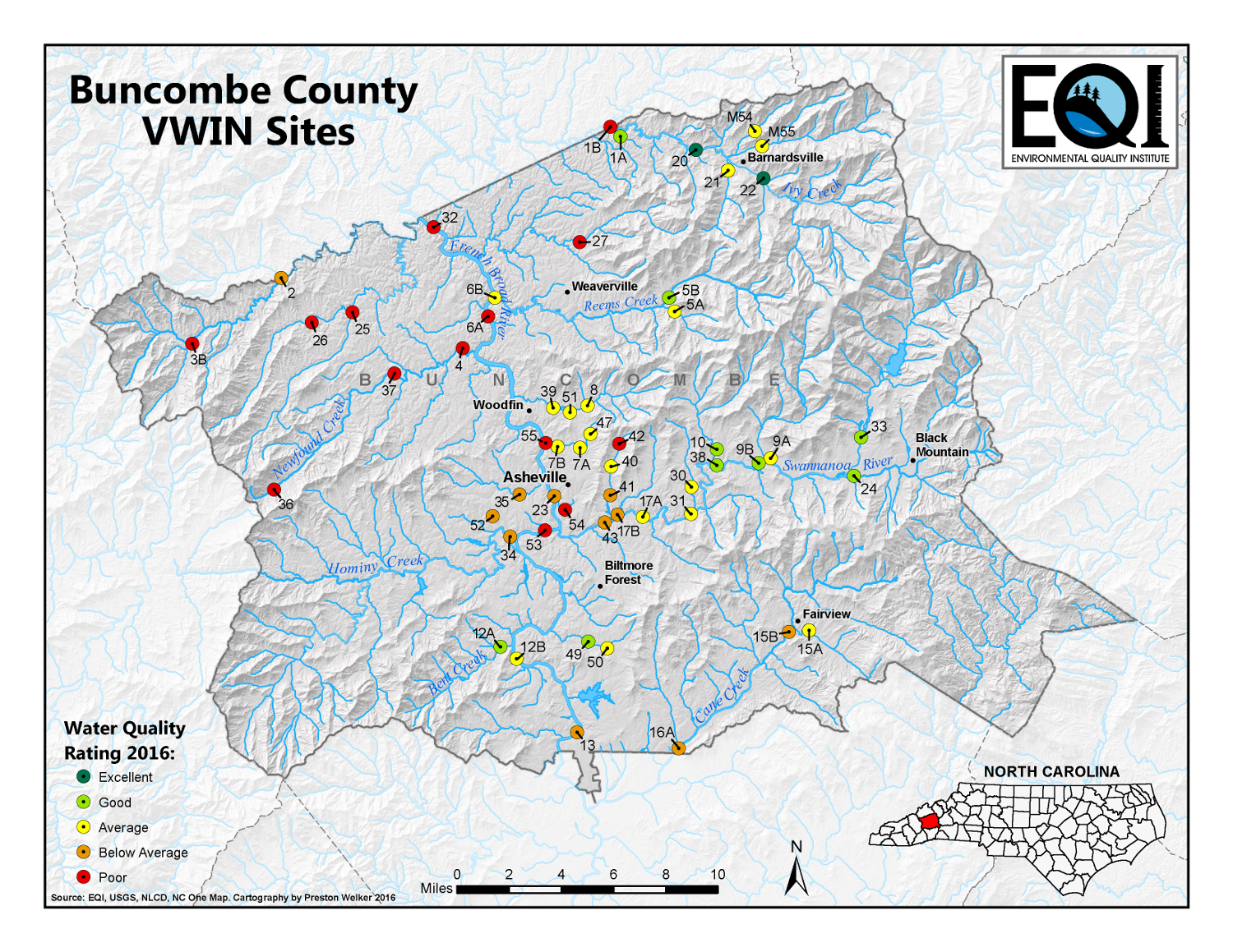
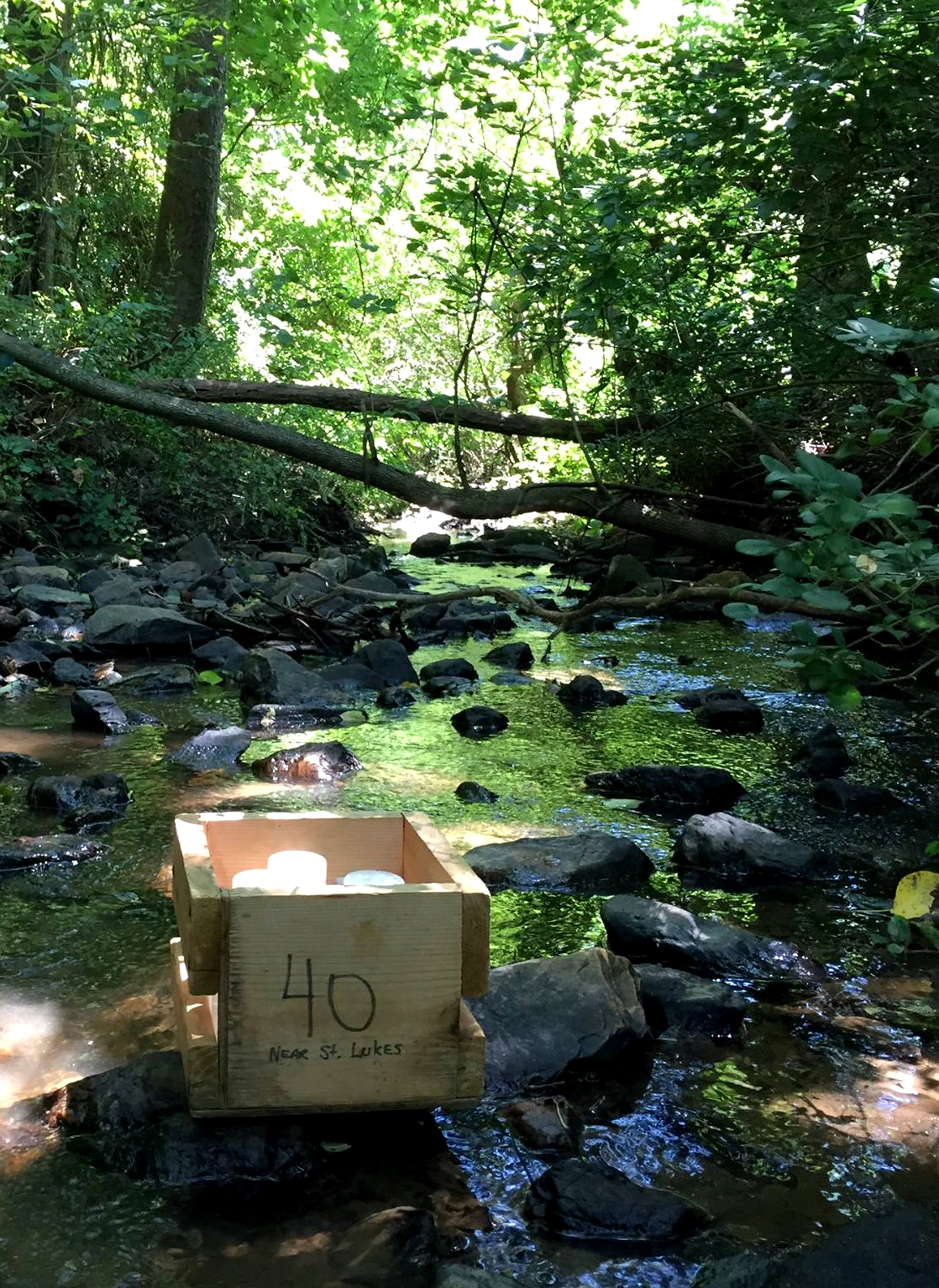
This collection of maps was created for The Environmental Quality Institute (EQI) to supplement their annual water quality report. Each month volunteer citizen-scientists collect water samples at specific sites along streams and waterways in Western North Carolina. This is known as the Volunteer Water Information Network (VWIN) project. Sampling locations are strategically placed in key areas in an attempt to fully capture an understanding of water quality in the watershed. Some locations have been sampled for over twenty-five years. These samples are returned to the EQI Lab to be analyzed for eight chemical parameters. After three years of sampling, a water quality rating can be derived.
EQI also maintains a complementary biological water quality monitoring program called the Stream Monitoring Information Exchange (SMIE). Combined, VWIN and SMIE provide a dependable and objective analysis of waterway health.
EQI also maintains a complementary biological water quality monitoring program called the Stream Monitoring Information Exchange (SMIE). Combined, VWIN and SMIE provide a dependable and objective analysis of waterway health.


Other EQI News and Media:
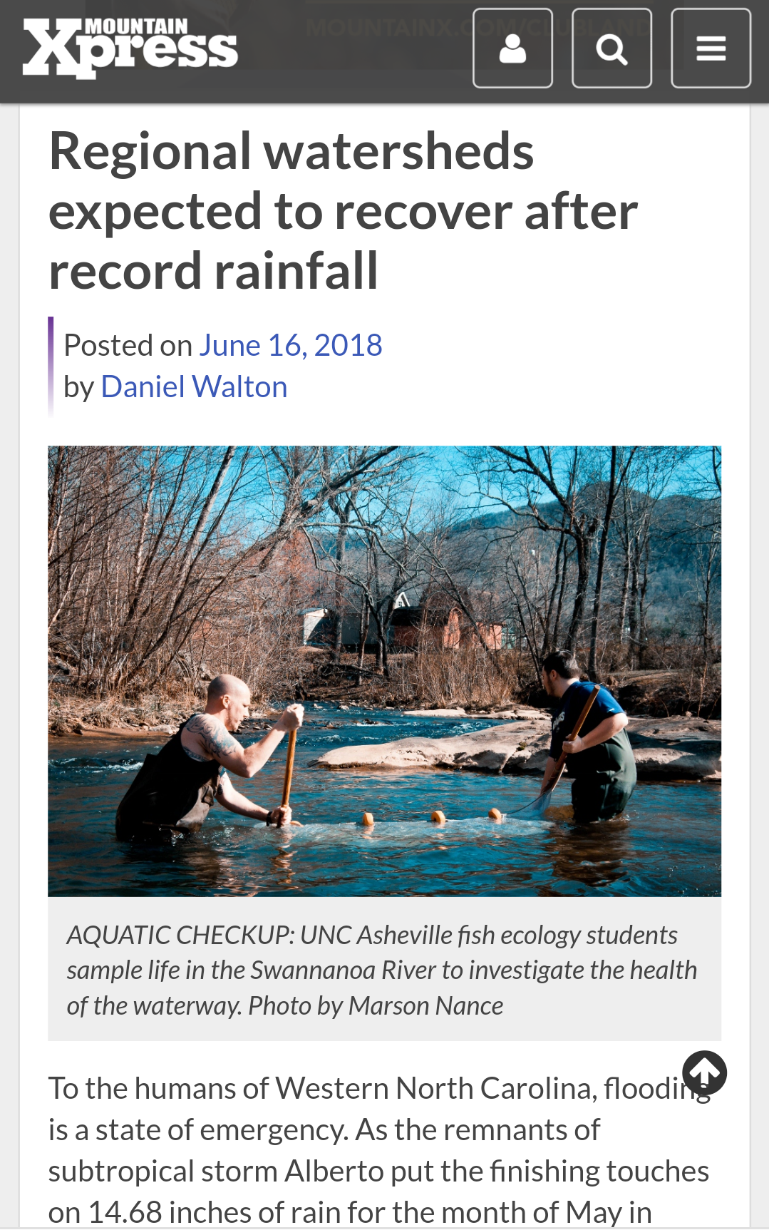
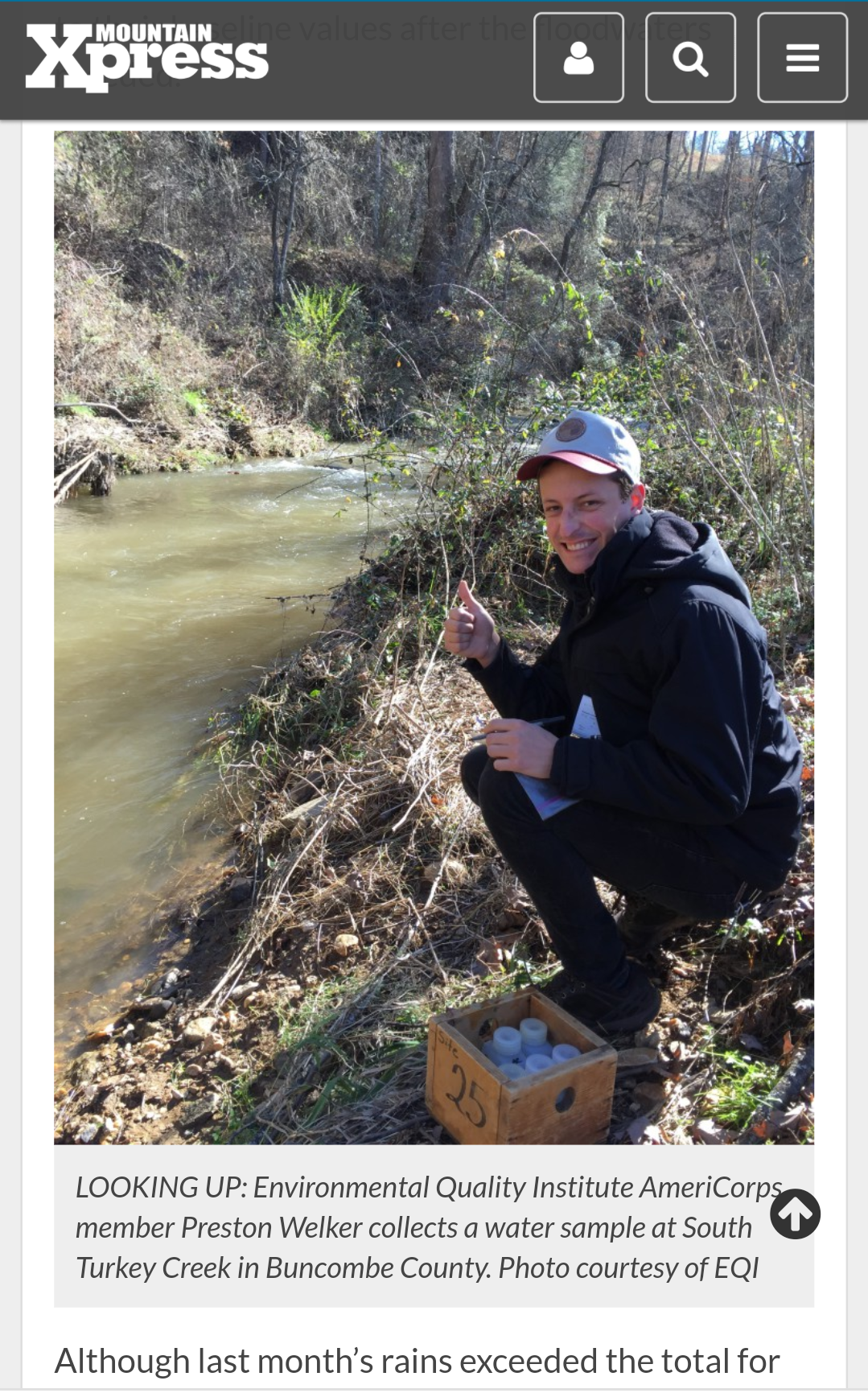
- Referenced in the Mountain Express regarding previous work in water quality monitoring. -North Carolina, June 2018
Map featured in newsletter for the organization Ivy River Partners. -North Carolina, August 2016
![]()

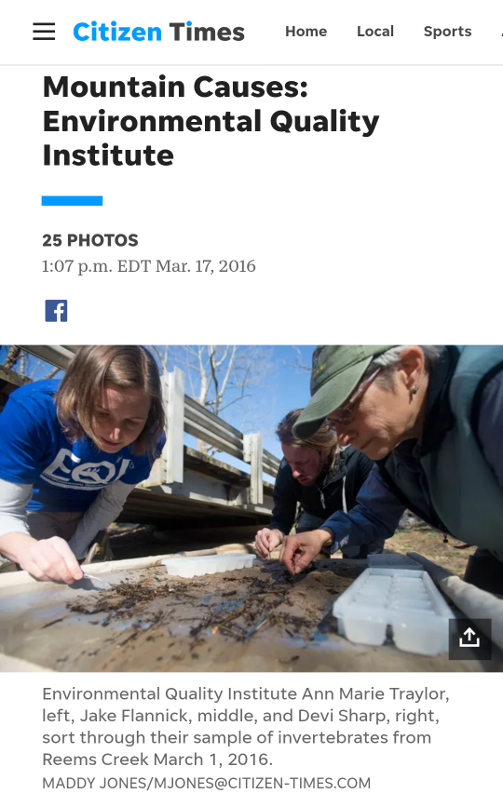
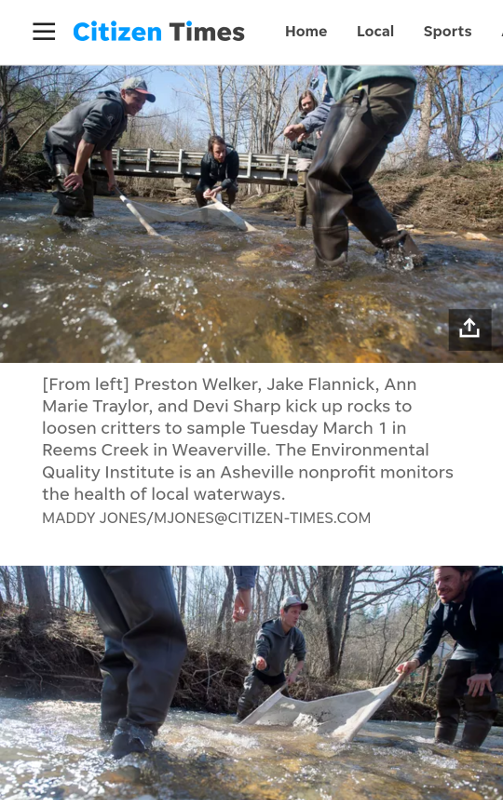
- Coordinated write up in Asheville Citizen Times for the Environmental Quality Institute. -North Carolina, March 2016
![]()
![]()